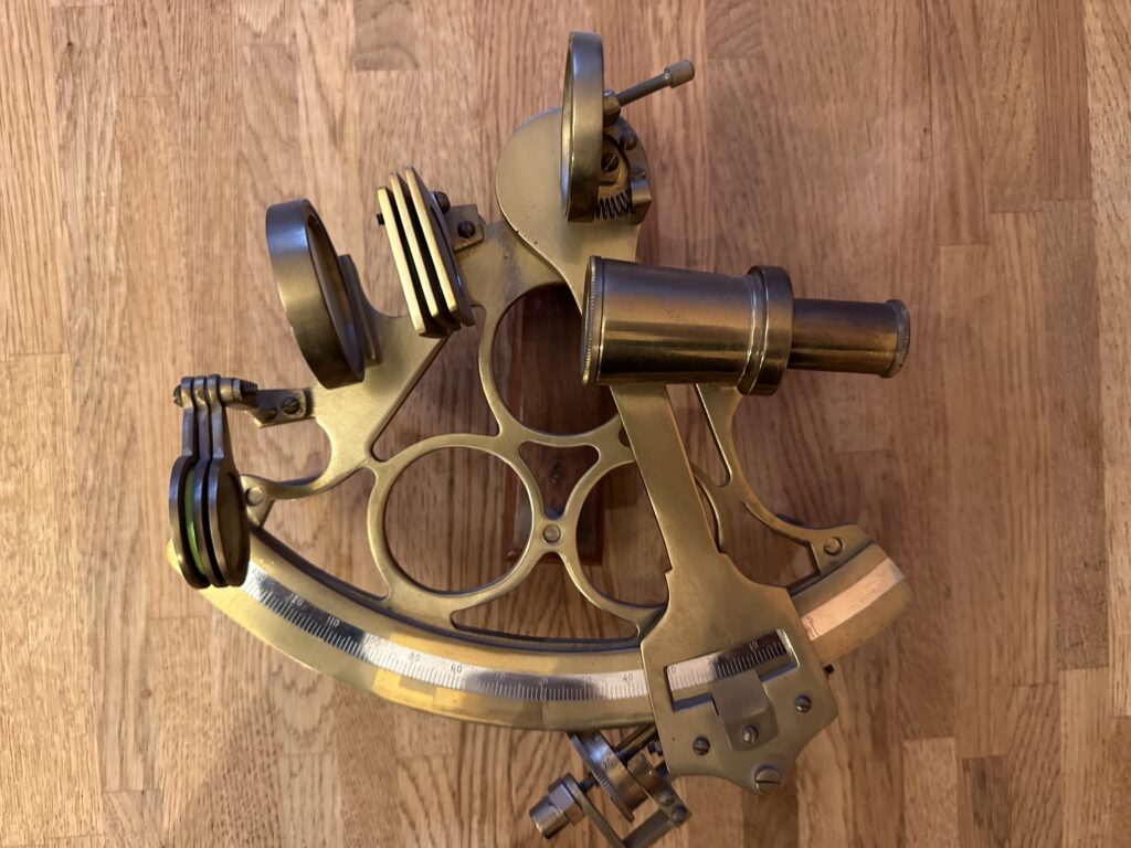
Seafarers have long been able to determine their latitude (that is the angle in degrees, minutes and seconds north or south of the equator. This is called declination) by measuring the angle between stars and the horizon. The easiest example of this is the pole star, Polaris which is located less than one degree from the celestial North Pole. Mariners would use a quadrant or sextant (below) to measure the angle between Polaris and the horizon. If, like me, you are 55.58 degrees north of the equator then Polaris will have a declination of 55.58 degrees above the horizon. Other heavenly bodies can be used but will require the use of tables to extract the latitude. That’s pretty straightforward but longitude was to prove a rather trickier problem.
Due to the fact that the earth spins on its axis once a day, it is necessary to have access to accurate time to determine longitude. For example, if you possessed sunrise tables and an accurate clock you could guesstimate your longitude when the sun rose. As clocks of that era were largely of the pendulum variety which for obvious reasons wouldn’t work on a ship, a new approach was required.
Due to numerous shipping losses, the British government created a Board of Longitude to encourage research into a method of determining longitude. A prize of £20,000 was on offer to the solver of this problem. £20,000 equates to around £1.5 million in todays money.
Various cunning schemes were devised but the ultimate solution was to find an accurate timepiece. In the early 1700s with few exceptions, clocks were not particularly accurate. The prize required a method of calculating longitude within half a degree at the end of a voyage to the West Indies.
In 1735, a Yorkshireman named John Harrison developed a chronometer which he submitted for the prize. his next three chronometers were smaller and more accurate than their predecessors. His no 4 chronometer was found to be only 5 seconds adrift at the end of a voyage to the West Indies. This would equate to around 30 metres which by any standards is pretty good. It took the Board of Longitude 10 years to pay Harrison his prize in full.
We are not sure how much of Explorer’s navigation would have been by celestial means as she was fitted with a “Decca Navigator” radio navigation system which would give very accurate position fixes if in range of the signals. Outside Decca chain coverage there is a high probability of the mates fixing the Explorer’s position by celestial navigation. The Explorer’s in service chronometer is no longer with the ship having likely been removed by the owners on her disposal. However…..
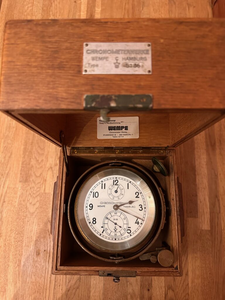
This chronometer by Wempe of Hamburg was gifted to the Society a couple of years ago. I haven’t calibrated this instrument but typically a chronometer would be expected to be accurate to one second per day. Also the deviation should be consistent in order that the correct time can be extrapolated.