The Decca Navigator
Today, we take for granted the ability to define our exact position on the planet using Global Navigation Satellite Systems (GNSS) whether on our boats, cars or smartphones. GNSS was first available circa 1978, a bit late for the Explorer.
Prior to the introduction of Decca, navigation in coastal waters was carried out by visual fixes of charted landmarks if the visibility was sufficient. Deep sea, celestial navigation was the order of the day if visibility and cloud cover permitted sight of the sun and stars. Otherwise, dead reckoning, the estimation of the ships position using the ship’s speed, heading, tidal drift, leeway and depth contours was the order of the day. A skilled mariner could achieve remarkable accuracy with dead reckoning but it was still a bit of a hit or miss affair. Casualties due to navigation errors were common.
The fitting of Decca to Explorer may have been early in her service if not on commissioning as it was certainly available to civil craft in 1955. Unfortunately we have no records as to when it was first installed. As you will read below it became an essential tool in her research mission.
Decca was essentially a short range navigation system with a range of 200 to 400 miles varying between day and night. It was however extremely accurate for it’s time.
Navigating the Seas and Skies.
Introduction:
In the world of navigation technology, this Decca stands as a pioneering system that revolutionized air and marine navigation. Developed in the early 1940s, the it provided accurate positional information, enabling pilots and sailors to navigate with precision. In this blog, we will explore the history, functioning, and significance of the system
1. The Origins:
It was originally developed by the Decca Company, a British engineering firm, during World War II. Primarily used by the Royal Air Force and the Royal Navy to navigate through challenging terrains and waterways. After the war, it quickly gained popularity in the civilian sector due to its accuracy and reliability.
2. How Does it Work?
The equipment operates on a principle known as hyperbolic navigation. It relies on a network of ground-based transmitting stations that emit low-frequency radio signals. By measuring the time difference between the reception of these signals, the navigator can determine the user’s position. A unique set of three signals, known as “chains,” provided data to obtain accurate positional fixes.
3. Advantages:
It offered several advantages over traditional navigation systems of its time. Firstly, it provided accurate positional information, allowing pilots and sailors to navigate safely, especially in areas with limited visibility or challenging terrain. Additionally, it was relatively simple to operate and did not require extensive training, making it accessible to a wide range of users.
4. Global Impact:
The Decca Navigator’s impact extended far beyond its country of origin. It quickly gained popularity worldwide, with installations in various countries, including the United States, Australia, and Canada. The system played a crucial role in maritime navigation, particularly during the Cold War, when accurate positioning was vital for military and commercial purposes.
5. Legacy and Evolution:
While the Decca Navigator was widely used for several decades, advancements in technology eventually rendered it obsolete. The advent of satellite-based navigation systems, such as GPS, offered greater accuracy and global coverage. However, the Decca Navigator’s legacy lives on as a significant milestone in the history of electronic navigation technology.
Conclusion:
It played a pivotal role in shaping the field of navigation, offering accurate positional information to pilots and sailors for several decades. Its impact on both military and civilian navigation was substantial, providing a reliable means of navigation in challenging environments. Although the Decca Navigator has been replaced by more advanced systems, its contribution to the development of navigation technology should not be forgotten.
The Decca Navigator Plotter
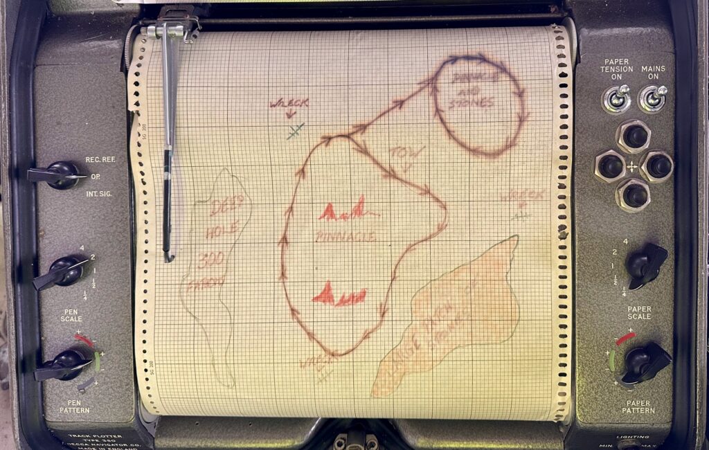
This is a photo of the Decca Chartplotter on the SS Explorer. It is unlikely that the trace defined by the arrows is the plot from the Decca Navigator and is probably hand drawn as an illustration. Charted details have been transferred by hand to the trace. The photo does however illustrate the use and the usefulness of the plotter.
Title: Plotting a track with the Decca Navigator Plotter.
Introduction:
In the realm of navigation, precision and accuracy are paramount. The Decca Navigator Plotter, a companion tool to the Decca Navigator system, played a crucial role in helping sailors and pilots record their tracks with precision. Here we will delve into the history, features, and significance of the Decca Navigator Plotter.
1. Understanding the Decca Navigator Plotter:
The Decca Navigator Plotter was a specialized tool designed to work in conjunction with the Decca Navigation system. It allowed users to plot their tracks accurately on rolling charts, facilitating course recording. The plotter was a great instrument for using the information provided by the Decca Navigator system effectively.
2. Features and Functionality:
The Decca Navigator Plotter consisted of a paper roll marked with a grid pattern. By aligning the cursor with the Decca Navigator’s positional fix, crews could record their track with precision.
3. Benefits and Advantages:
The Decca Navigator Plotter offered several advantages to users. Firstly, it provided a visual representation of the vessels track, making it easier to interpret and plot on a navigational chart. The plotter facilitated accurate navigation over desired patterns. For example if it was desired to fish in a certain pattern without fishing the same spot twice. It could also facilitate a box search for search and rescue missions.
4. Significance in Navigation:
The Decca Navigator Plotter played a vital role in both aviation and maritime navigation. It enabled pilots and sailors to navigate accurately, especially when operating in areas with limited visibility or complex terrains. The plotter’s ease of use and compatibility with the Decca Navigator system made it a valuable tool for navigators worldwide.
5. Legacy and Evolution:
With advancements in technology, the Decca Navigator Plotter, like its companion system, eventually became obsolete. The emergence of satellite-based navigation systems provided even greater accuracy and convenience. However, the Decca Navigator Plotter’s legacy lives on as a testament to the ingenuity and innovation of navigation tools that paved the way for modern-day navigation systems.
Conclusion:
The Decca Navigator Plotter was an indispensable tool for pilots and sailors, allowing them to plot their courses accurately and navigate with precision. Its compatibility with the Decca Navigator system made it a valuable asset in the field of navigation.
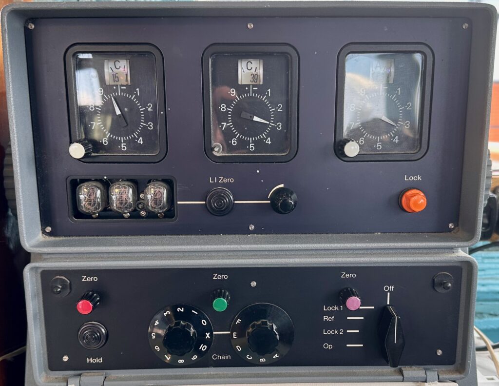
Explorer's Decca.
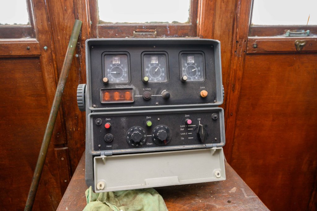
This is a scruffy photo of Explorer’s Decca receiver. It is currently stored in a safe dry compartment. It will be cleaned up before being returned to the wheelhousewhes the wheelhouse has been restored.
How does it work?
You may be wondering how a vessel’s position can be defined using three dials. I won’t get too technical because I too am semi clueless (but if you do feel the need for rocket science it is available in the link below)
A Decca chain, is the term for the shore based transmitters consisting of a master and two or three slave transmitters. They are accurately sited and each broadcasts on a discrete continuous frequency. The transmitters are positioned at precisely surveyed locations. When the signal is received by the ship a phase difference can be measured between signals which the equipment can translate into co-ordinates to plot on a suitable Decca overlaid chart. The slaves are designated purple, red and green (referred to as lanes).
I believe the dials in the above photo receive from left to right the red, green and purple lanes. In isolation that doesn’t give us much idea of our position. We need the next piece of the puzzle.
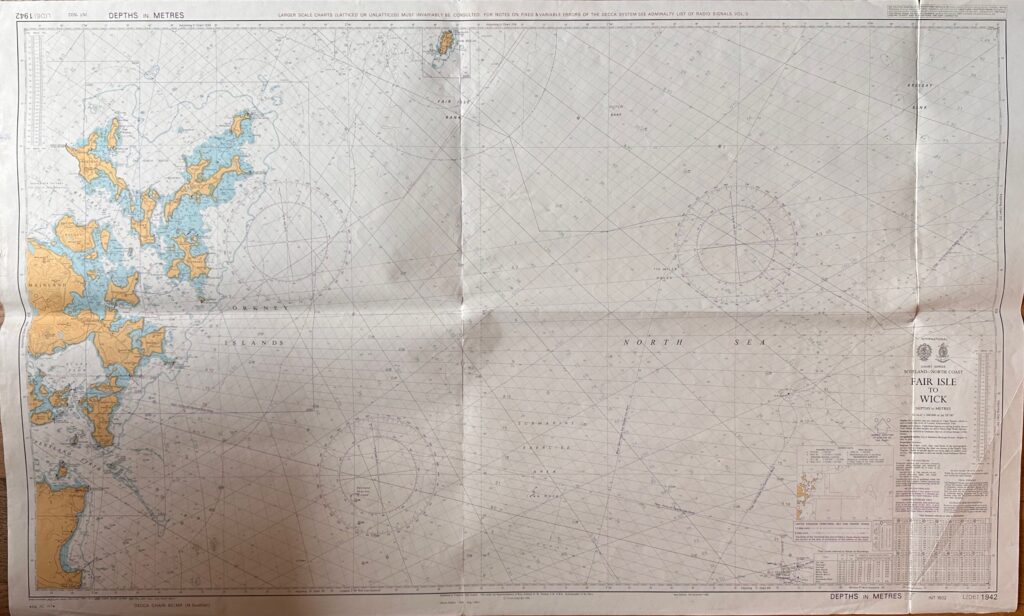
Decca Charts
The chart pictured above shows the Admiralty chart of Fair Isle to Wick with a Decca overlay.
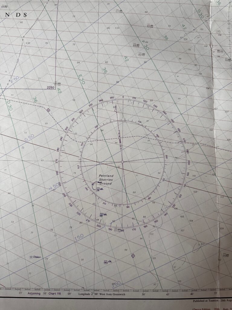
Detail of the above chart
This detail of the above chart shows more clearly the Decca overlay. To plot the vessel’s position the readings from the navigator must be transferred to the paper chart of which more details below in the rocket science link. This section of the chart appears to have three fixes plotted although the hieroglyphics are unclear to the author. Also of note is that the fixes appear to be made with ink which is unusual as erasable pencil is normally used.